Environmentally Sensitive & Natural Areas - Environmental Quality Modeling Study
This study was completed by Tyler Rankin (Forest Health Specialist) using the OKI Regional Council of Governments' Environmental Mitigation Suitability Modeler (EMSM)/Greenspace Environment & Mitigation Mapper (GEMM). The modeler was used to designate the most environmentally sensitive/highest quality natural areas in Boone County. Methods and results can be found in the following storymap and report.
Boone County Ohio River Initiative 2024 Summary Report
The following report and storymap compiles potential opportunities and challenges for increased river access, conservation projects, and recreational opportunities as discussed between river town communities and BCORI members.
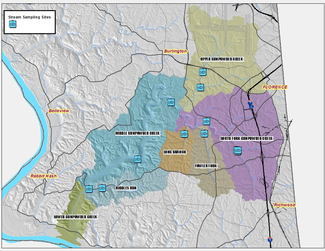
Gunpowder Creek Watershed Plan
The largest drainage catchment in Boone County, our Gunpowder Creek Watershed drains 58.2 square miles into the Ohio River. Our Watershed Plan outlines conservation efforts to improve water quality and natural habitat throughout the basin.
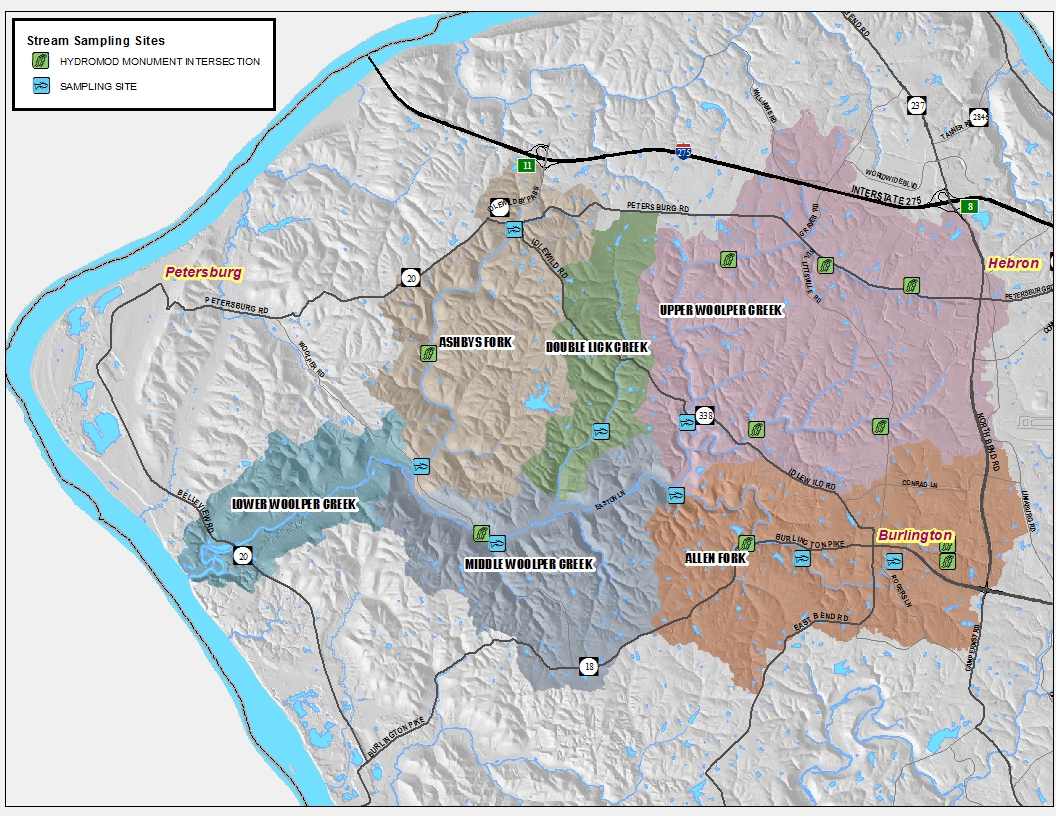
Woolper Creek Watershed Plan
Containing over 140 miles of streams, our Woolper Creek Watershed drains 33 square miles of Boone County into the Ohio River.
Our Watershed Plan outlines conservation efforts to improve water quality and natural habitat throughout the basin.
Explore your Community with Boone County GIS
Whether you are a land manager, business owner, educator, student, or curious citizen, the mapping tools provided by Boone County GIS can help you see your community in a new way. Boone County GIS provides fast and easy access to accurate digital and hard-copy mapping data, as well as computerized spatial analytical services, which improves decision-making.
VISIT BOONE COUNTY GIS MAPPING TOOLS
ARCHIVED AERIAL PHOTOS
The State of Boone County Agriculture - 2010
The study includes a profile of the county’s agriculture industry, results from a survey of
Boone County farmers, and a Cost of Community Services Study that shows a snapshot in time
of the impact of agriculture on the county’s economy. The study was prepared under the
guidance of the Boone County Conservation District and members of the Boone County Farm
Initiative. The study was funded by grants from the Kentucky Soil and Water Commission.